[:de]
Orientierung und Navigation: Eine Karte richtig Einnorden
Um eine Karte Einzunorden benötigen wir eine Karte und einen Kompass. Hierbei helfen uns die Schrift die Richtig zu lesen ist wenn sie nach norden Zeigt, also befinden sich norden immer am oberen Rand wenn ihr die Karte lesen könnt.
Um die Karte aber mit der Landschaft richtig auszurichten reicht es nciht die Schrift lesen zu können, jetzt kommt der Kompass ins Spiel. Da die Kompassnadel immer nach Norden zeigt können wir anhand der Kompassnadel die Karte genau mit dem Gelände ausrichten.
Hierzu legen wir die Karte auf einen Untergrund der nicht aus Metall ist, und entfernen am besten auch grosse metallische Gegenstände von unserer Karte.
Wir legen nun den Kompass mit der Massstabs-Tabelle an den Kartenrand oder richten die Massstab-Tabelle an dem Gitternetz aus ( von unten nach oben, von Süden nach Norden).
Nun drehen wir die Karte mit dem Kompass so lange bis die Nadel Eingenordet ist ( Linseatischer Kompass – Norden zeigt auf Peilstrich ) .
Schon haben wir die Karte Eingenordet!
ACHTUNG nun kann es durch aus vorkommen das wir von unserer Position aus die Schrift auf dem Kopf lesen dies ist aber kein Fehler! Ein Fehler wäre es nun die Karte so zu drehen das wir die Schrift wieder lesen können.
Sobald die Karte Eingenordet wurde von euch stimmt sie mit dem vorhandenem Gelände überein, und wir können mit dem Orientieren beginnen.
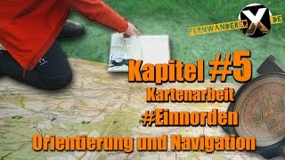
Sieh dir die Video Anleitung an :
Kompass und Karte – Die Karte Einnorden
Navigation und Orientierung – Kompass – Kompasse – Marschzahl – Einnorden – Kartenarbeit mit Kompass – Nordpol – Kreuzpeilung – Rückwärts Einschneiden – Standort ermitteln – Seitwärts einschneiden – Marschzahl ermitteln – Azimut – Anpeilen – Gradeinteilung – Altgrag und Grad – Artellerie Promille – Marschpeilung – Orientierungslauf – OL Lauf – Kompassrose – Norden Osten Süden Westen – Taschenkompass – Linealkompass – Plattenkompass – Spiegelkompass – Linseatische Kompass – Prismenkompass – Kartenkompass – Peilkompass – Wanderkompass – Peilen – Standlinie –[:en]
Orientation and Navigation: A map correctly to north
A card Einzunorden we need a map and a compass. Here, the writing us help is correct to read when they visit north Displays, that are located north always at the top if you can read the card. But in order to properly align the card with the landscape ranges it nciht be able to read the writing, the compass now comes into play. Since the compass needle always points north puttygen ssh ↗ , we can map exactly with the terrain ausrichten.Hierzu we place the map on a background that is not made of metal, and is best removed even large metal objects on our map using the compass needle. We now place the compass with the measuring rule table at the edge of the card or set the scale table to the grid of (from bottom to top, from south to north).
Attention now it can happen through out the we read of our position from the writing on the head but this is not a mistake! An error it would now rotate the map so that we can read the writing again.
Once the card is facing north of you match the existing terrain in agreement, and we can start with the Orient.
watch the video tutorial and find out how to map to north
[:] PuTTY SSH tunnel RDP ↗ Buy Doxycycline without Prescription ↗